
免费


关闭纠错举报
我站仅对该软件提供链接服务,该软件内容来自于第三方上传分享,版权问题均与我站无关。如果该软件触犯了您的权利,请点此版权申诉。
+ 展开全部应用介绍
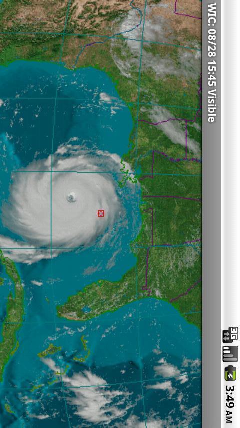
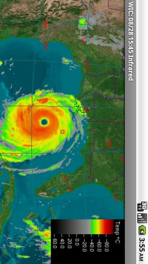
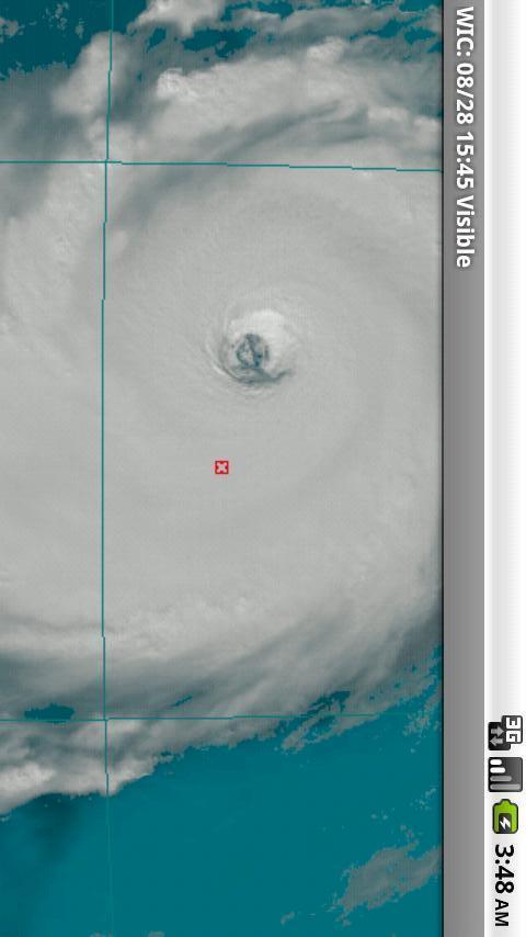
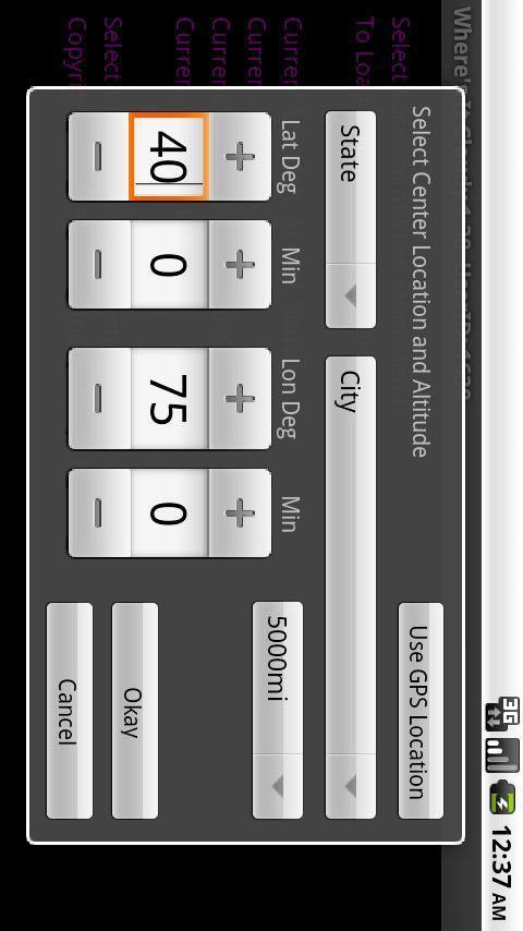
Shows detailed real-time high resolution images from Weather Satellites.Wheres It Cloudy? is an Android application that shows real-time satellite data from the American Geostationary Weather Satellites. As a mobile phone app, you may access it to find out where its cloudy in the vicinity of where you are located, or anywhere in the eastern and central United States and southern Canada. Most other weather apps do not show satellite imagery; they only show radar data. Radar data is effective at showing where there is rain and snow, but it doesnt show where clouds are located. Currently the App will NOT show imagery covering the West Coast.The satellite data shown in Wheres It Cloudy? is ideal for several purposes including:* showing cloudy regions* detecting the likelihood of precipitation* helping track moderate to severe storms and hurricanes* showing the movement, rotation, and structure of storms* display of images in a time-lapsed loop.Traditional weather applications show imagery covering only predefined areas at predefined resolutions. Wheres It Cloudy? goes beyond this to allow the user to choose a default viewing point anywhere in North America, and a viewing altitude that determines the area the image will cover. A cloud computing platform renders the data based on your selections. The Cloud for Clouds!!Once you set your default location and altitude, the image loops are dynamically generated at the maximum possible resolution from a 3D model of the Earth with the real time satellite imagery overlaid on this realistic model. This provides stunning and accurate visuals, especially in the Visible channel of satellite data.Unlike other programs that may show the satellite imagery in a few shades at a reduced level of detail Wheres it cloudy shows satellite imagery in full detail and in as many shades as are possible on your device. We also do not use lossy compression to preserve as much detail as possible. If you select Tru-Sat Image it will show the raw satellite image as it was imaged from the satellite which in many cases can show much more detail. Give it a try you will be impressed.
应用截图
你可能还会喜欢
-
 类型:办公商务
-
 类型:生活地图
-
 类型:动作冒险
-
 类型:生活地图
-
 类型:阅读学习
-
 类型:其它
类型:其它
发表评论共有 0 条游戏评论
- 本游戏还没有玩家发表评论,快来抢占沙发吧:)
发表评论

同类热门推荐
-
 类型:其它
类型:其它
-
 类型:休闲益智
-
类型:生活地图
-
 类型:壁纸主题
-
 类型:聊天通讯
-
类型:其它


