关闭纠错举报
我站仅对该软件提供链接服务,该软件内容来自于第三方上传分享,版权问题均与我站无关。如果该软件触犯了您的权利,请点此版权申诉。
+ 展开全部应用介绍
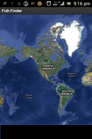
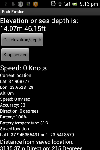
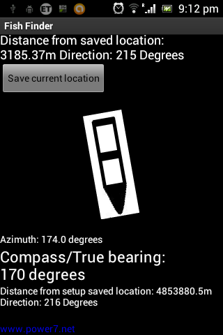
Android Marine Navigator for tablets.Same application with Marine Navigator - Fish finder to work for tablets.Visit my site: http://www.power7.netMarine navigator, Depth meter, Vessel Calendar, Fish finder, Boat GPS is an application for kayaks, boats, cruisers, yachts, ships, fishermen, skippers, captains to help to find the location, the speed, the direction, the sea depth, helps you to save your fish area location,the mooring or another point and more others functions.Also shows the distance,bearings between saved point and the current location.Another user from home or another boat or any earth point can find (track) your location (user choice) from a web browser.For upload data or find elevation/depth need internet connection for download some bytes data with very small cost for mobile network.If you use maps the data is more some Kbytes.If you are in a long range area, far from mobile cellphones networks you can connect your android with Iridium axcesspoint wifi hotspot for establish connection from anywhere on Earth with a view of the sky with mine or your web server or to find the depth or the eleveation.Also shows digital compass, true bearing, azimuth.Added a SOS buton inside menu.If you press it send sms to administrator number your location and the word SOS.Also this application is suitable for climpers,explorers,hunters....because shows and the elevation.I suggest to use the encryption number key if you select to upload data to my web server.Receiver user can use decryption for find track the other user location.You can erase webserver data with erase server button from setup menu.User can choice if want to upload data to my web server.Work as Internet VHF channel for communication between team users.I changed the file to upload data for this application to http://www.power7.net/marineloc.phpIf you want to see the upload data visit http://power7.net/marineloc.txtShare your track and position with friends or boats team or family instantly and in real time via sms or cloud (internet).Also i added a map to show your position in real time.You can see your position in real time in the map, or other users of my apk if uploads data to my web server.In the next version you will can plot routes.I will add system for avoid collisions and others functions for safe marine navigation.Added Alarm Elevation or Sea depth, for example when depth is higher > - 10 m the alarm fire or when depth is lower < - 200m.The alarm zone must setup from user.Needs internet connection to work this function!!!The accuracy is not the same such as a real depth meter near the land.Added new function: You can create account into my site, register page for use as vessel calendar.If you use username, enable upload server and run my application you can see your history location private data into Login page after login.Also store your last location in SD card.New function:1. Added Geofense alarm.When lat>y1 or latx1 or lonFor not alarm fire set up as default values lat +180-180 lon +90-90.2.Location Name infos.3.Marine Weather infos.4.When you touch a point on map you can get the coordinates,distance,bearing from current location.Stay online and update it because i improve continuously my code!!!Visit my site http://www.power7.net/marine_navigator.html for more instructions and setup.For more details send me e-mail.
应用截图
你可能还会喜欢
发表评论共有 0 条软件评论
- 本软件还没有玩家发表评论,快来抢占沙发吧:)


