
免费


New Zealand Topo Maps Free
6(已有0人评分)我要评分
- 版 本:
- 2.6.2
- 类 型:
- 生活地图
- 下载量:
- 305
- 大 小:
- 4.38MB
- 时 间:
- 2017-06-09
- 语 言:
- 英文
关闭纠错举报
我站仅对该软件提供链接服务,该软件内容来自于第三方上传分享,版权问题均与我站无关。如果该软件触犯了您的权利,请点此版权申诉。
+ 展开全部应用介绍
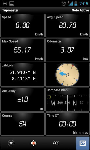
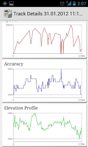
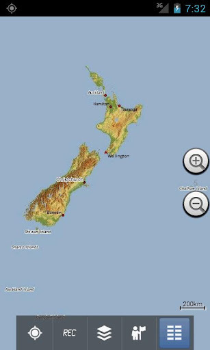
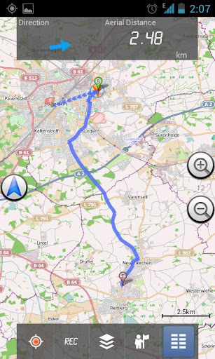
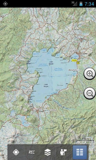
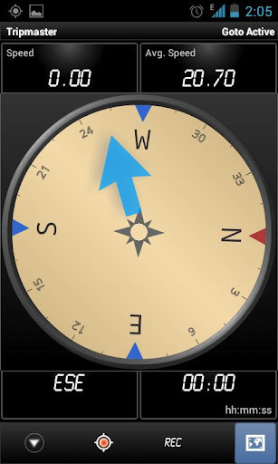
NZ Topographic Maps 1:50.000 Easy to use outdoor navigation app with most recent topographic maps of New Zealand, Cook Islands and Tokelau.This app gives you similar mapping options as you might know from Garmin or Magellan GPS handhelds. Main features for outdoor-navigation:• Create and edit Waypoints• GoTo-Waypoint-Navigation• Track Recording (with speed, elevation and accuracy profile)• Tripmaster with fields for odometer, average speed, bearing, elevation, etc. • GPX-Import / Export, KML-Export• Search (placenames, POIs, streets)• Customizable datafields in Map View and Tripmaster (e.g. Speed, Distance, Compass, ...)• Share Waypoints, Tracks or Routes (via eMail, Facebook, ..)• and many more ... LIMITATIONS OF THE FREE VERSION:• Ads• Max. 3 Waypoints• Max. 3 Tracks• No Routes• No import of waypoints and tracks• No Bulkdownload• No Local City DB (Offline Search) Available map layers:• Topomaps New Zealand (seamless coverage at scales 1:250.000 and 1:50.000)• Google Maps (Satellite images, Road- and Terrain-Map)• Open Street Maps (OSM Mapnik and Cloudemade Cyclemap) Use this navigation app for outdoor activities like hiking, biking, camping, climbing, riding, skiing, canoeing or offroad 4WD tours.Preload FREE map data for areas without cell service. (Pro version only) The topographic maps were created by Land Information New Zealand (LINZ). Topo50 is the official topographic map series used by New Zealand emergency services. How topographic information is usedDefence planning: New Zealand's defence forces use topographic information for planning military exercises and swapping information with international partners.Location and routing: Search and Rescue, defence, ambulance, fire service, police and civil defence agencies use topographic information in a wide range of planning and operational situations, from natural disasters to community policing. Usage may involve mobile/field and control room situations, and the combination of topographic information with other data.Land management: Topographic information is used by local government for regional planning and operations, and by power, gas and telecommunications companies.In addition, LINZ maps are used for a great variety of purposes by businesses and government departments such as the Department of Conservation, and by recreational users such as trampers and tourists. All topographic maps have additional labels for better readability at higher zoom scales. Maps are rendered with Atlogis® hillshading to enhance topography. Topo Map Coverage: New Zealand and Islands (Antipodes, Auckland, Bounty, Campbell, Chatham, Kermadec, Raoul, Snares and Stewart Islands) at scale 1:50.000 and 1:250.000Cook Islands (Aitutaki, Atiu, Mangaia, Manihiki, Mauke, Mitiaro, Palmerston, Penrhyn, Pukapuka, Rakahanga, Rarotonga, Suwarrow, Takute) at scale 1:25.000 Tokelau Islands (Atafu, Nukunonu, Fakaofo) at scale 1:25.000 Please send comments and feature requests to nzmaps@atlogis.com
应用截图
你可能还会喜欢
-
 类型:教育学习
-
 类型:网络游戏
-
 类型:飞行射击
-
 类型:购物优惠
-
 类型:休闲益智
-
 类型:体育竞速
发表评论共有 0 条软件评论
- 本软件还没有玩家发表评论,快来抢占沙发吧:)


