
免费


关闭纠错举报
我站仅对该软件提供链接服务,该软件内容来自于第三方上传分享,版权问题均与我站无关。如果该软件触犯了您的权利,请点此版权申诉。
+ 展开全部应用介绍
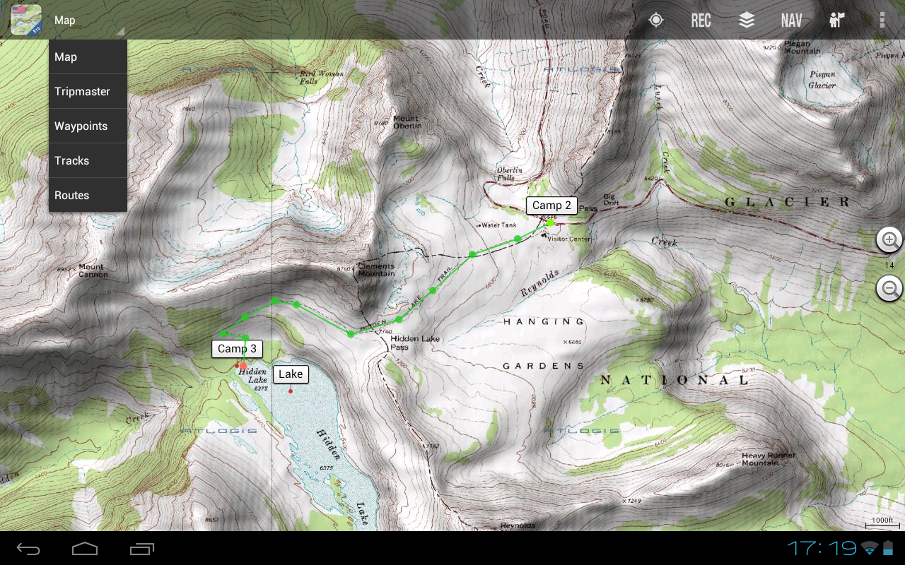
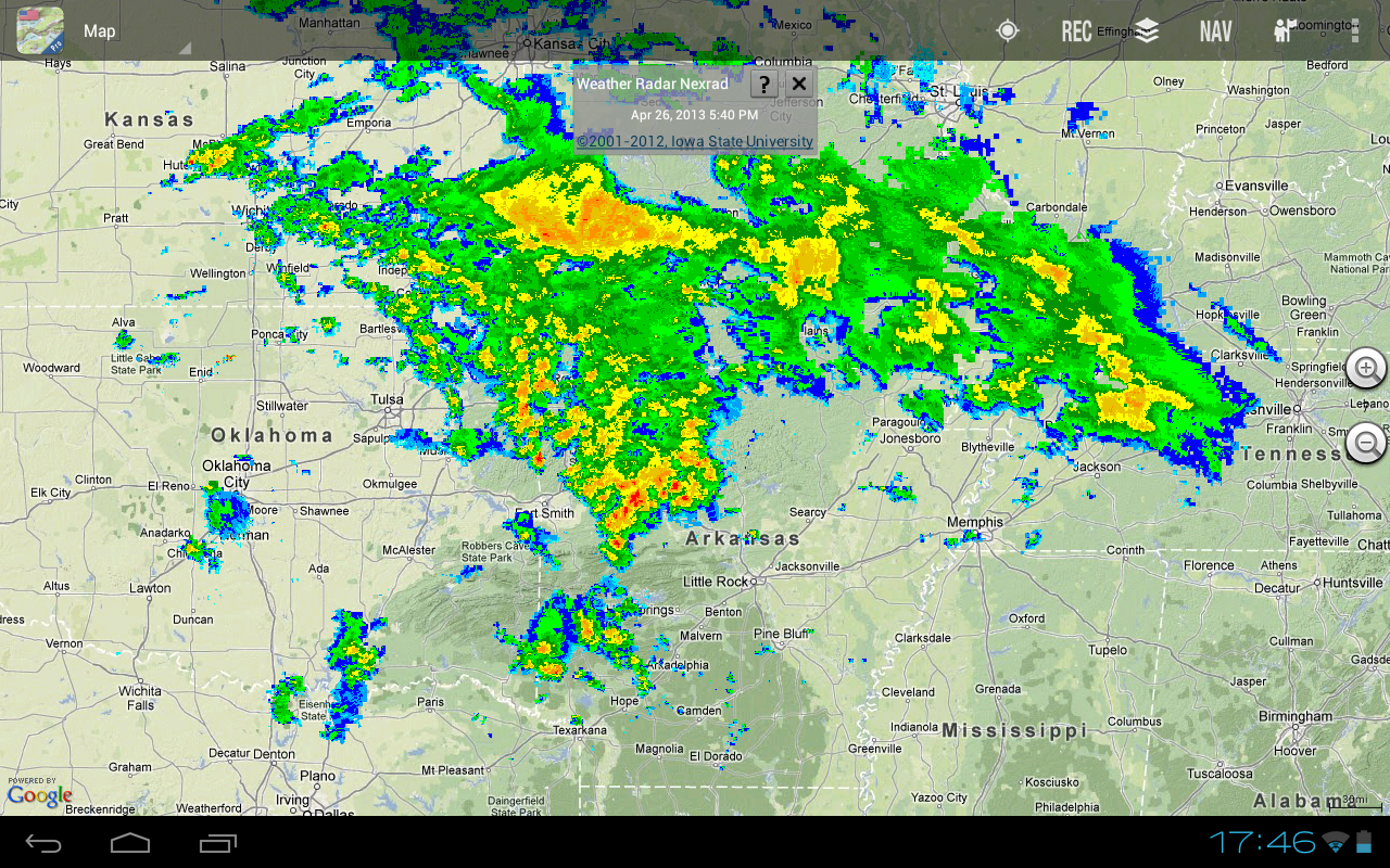
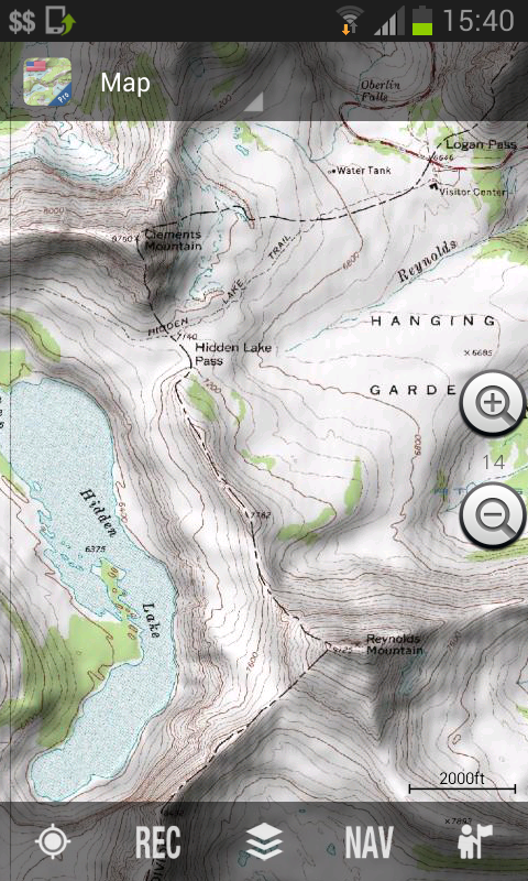
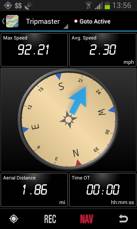
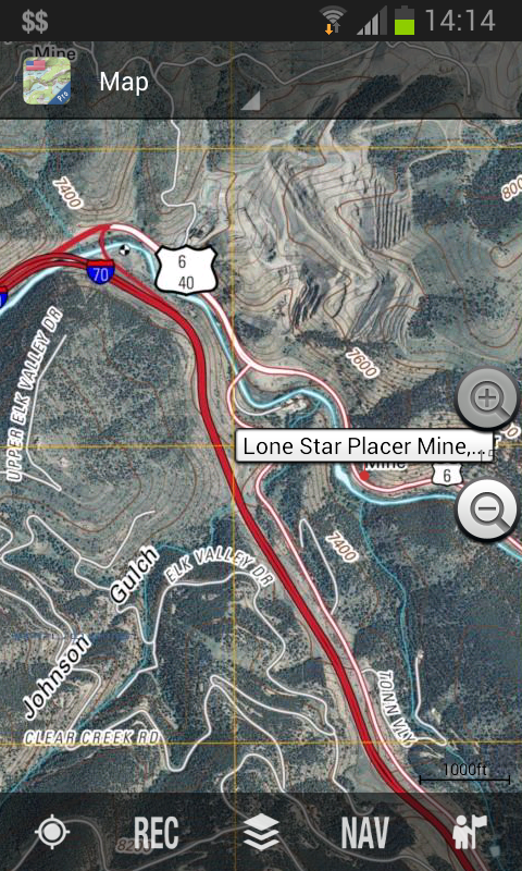
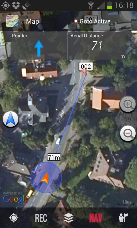
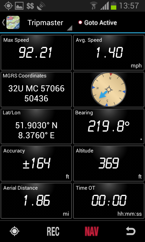
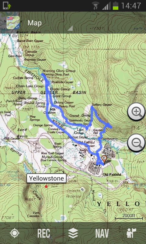
Easy to use outdoor navigation app with free access to the best topographic maps and aerial images for the USA.Turn your Andoid Phone/Tablet into an outdoor GPS for trips into the backcountry.This app gives you similar mapping options as you might know from Garmin GPS handhelds.Main features for outdoor-navigation:• Easy+Fast Bulk-download of map tiles for OFFLINE USAGE (PRO-VERSION ONLY !)• Display Real-Time nowCoast Weather Information and NEXRAD Weather Radar• Free access to more than 100.000 seamlessly stitched USGS topographic maps - easy to use as browsable map layer• Create and edit Waypoints• GoTo-Waypoint-Navigation• Create and edit Routes (PRO only !)• Route-Navigation (Point-to-Point Navigation)• Track Recording (with speed, elevation and accuracy profile)• Tripmaster with fields for odometer, average speed, bearing, elevation, etc. • GPX/KML/KMZ Import/Export• Search (placenames, POIs, streets)• Customizable datafields in Map View and Tripmaster (e.g. Speed, Distance, Compass, ...)• Share Waypoints, Tracks or Routes (via eMail, Dropbox, Facebook, ..)• Display coordinates in Lat/Lon, UTM or MGRS/USNG (Military Grid/ US National Grid), North America Lambert Conformal Conic (LCC)• and many more ...Available map layers:• USGS DRGs: Seamless coverage of topo maps of the USA at Scales 1:250.000, 1:100.000, 1:63.000 and 1:24.000/25.000• New US Topo maps (PRO ONLY !)• USGS High Resolution aerial imagery• NAIP Orthoimagery for conterminous US• Google Maps (Satellite images, Road- and Terrain-Map)• Bing Maps (Satellite images, Road-Map)• Open Street Maps (OSM Mapnik and Cloudemade Cyclemap)• Earth At NightAvailable map overlays: • Hillshading overlay layer for OSM, Google or Bing maps (PRO-VERSION ONLY !)• Ridge Weather Radar NWS• Wind, Temperature, Pressure• Wind Vectors• Precipitation Estimate - 1-hr• Precipitation Forecast 24h• Surface Air Temperature• Hazard Warnings• Tropical Cyclone Track• Wind Vector Forecast 24h• Max. Air Forecast 24h• Min. Air Forecast 24hUSGS DRG topographic maps:The 7.5-minute maps (1:24.000/1:25.000) are the best maps for outdoor activities in the USA. Although some of the maps are quite old, they contain many small pathes and 4WD tracks that are missing in new USTopos, Google, Bing and OSM maps.New US Topo Maps:US Topo maps are a graphic synthesis of The National Map data files and are produced in the familiar 7.5-minute by 7.5- minute geographic format. Current US Topo map layers include an orthoimage base, transportation, geographic names, topographic contours, boundaries, hydrography and woodlands. Also included are the Public Land Survey System (PLSS) and the United States National Grid.Currently US Topo maps cover about 75% of the conterminous US. Full coverage with latest maps will be available soon (est. Summer 2013)NAIP Orthoimagery:Seamless coverage of contiguous US with 1m/pixel resolutionHRO aerial imagery: High resolution arial photos covering US urban areas & borders (up to 10cm/pixel)Use this navigation app for outdoor activities like hiking, biking, camping, climbing, riding, skiing, canoeing, hunting, snowmobile tours, offroad 4WD tours or search&rescue (SAR).Add custom waypoints in longitude/latitude, UTM or MGRS/USNG format with WGS84 datum.Import/Export/Share GPS-Waypoints/Tracks/Routes in GPX or Google Earth KML/KMZ format. (PRO-VERSION ONLY !)View Real-time nowCoast weather information like temperature or windvectors and overlay to map. See animated NEXRAD rain radar to make accurate predictions when raining will start/stop (PRO-VERSION ONLY !). LIMITATIONS OF THE FREE VERSION:• Ads• No Bulkdownload• No new) US-Topos layer• No Hillshading overlay• Max. 3 Waypoints• Max. 3 Tracks• No Routes• No import of waypoints and tracks• No Local City DB (Offline Search)US topographic maps are enhanced with Atlogis® hillshading and placenames.Please send comments and feature requests to usmaps@atlogis.com
应用截图
你可能还会喜欢
-
 类型:飞行射击
-
 类型:模拟辅助
-
 类型:聊天通讯
-
 类型:阅读学习
-
 类型:壁纸主题
-
 类型:影音图像
发表评论共有 0 条软件评论
- 本软件还没有玩家发表评论,快来抢占沙发吧:)


