
免费


关闭纠错举报
我站仅对该软件提供链接服务,该软件内容来自于第三方上传分享,版权问题均与我站无关。如果该软件触犯了您的权利,请点此版权申诉。
+ 展开全部应用介绍
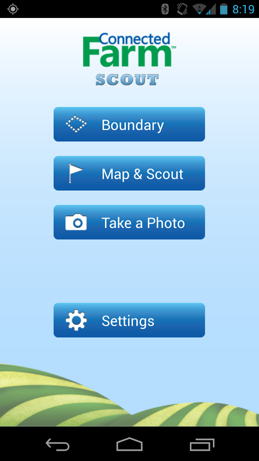
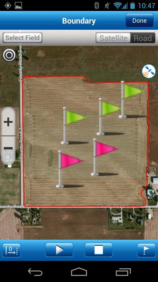
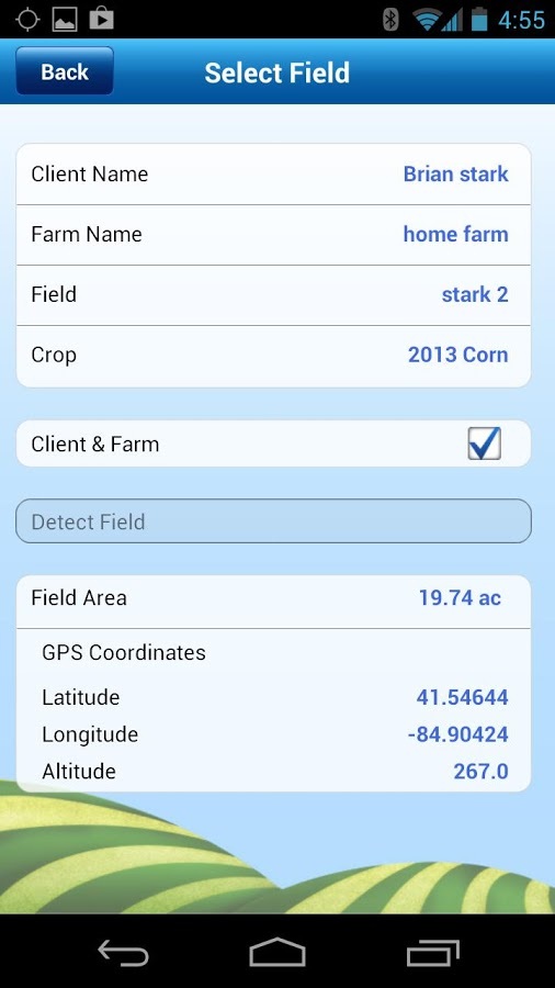
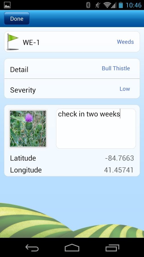
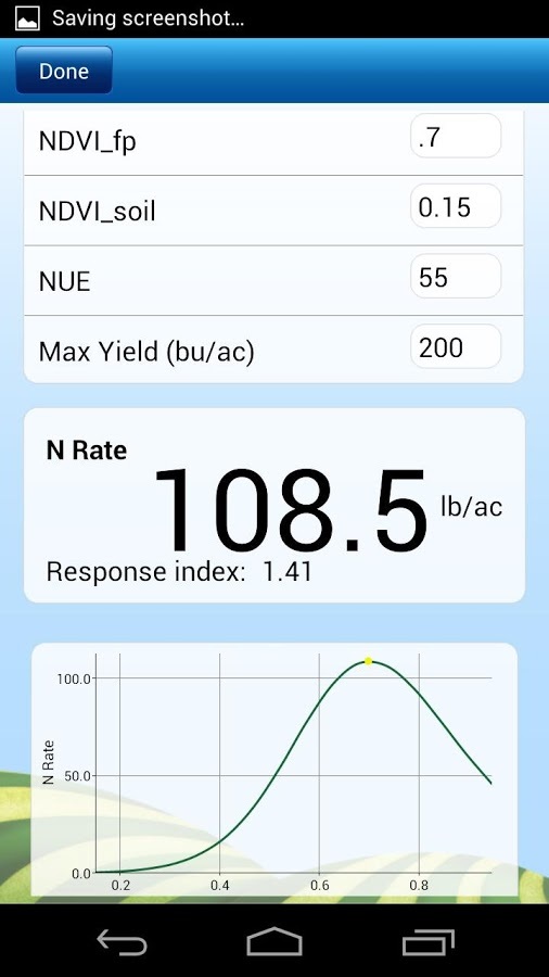
Change the way you use GPS for field mapping and scouting applications in agriculture. Trimble’s Connected Farm™ scout app uses your phone's GPS for mapping field boundaries, locate irrigation pivots, marking flags, and entering scouting information for points, lines, and polygon areas. Scouting attributes include an extensive list of weeds, insects and diseases, and allows you to log the severity of a problem, crop conditions, and more. Photos can be captured and integrated with your scouting attributes. The Connected Farm scout app is also compatible with Trimble’s GreenSeeker handheld crop sensor. Start by entering NDVI (Normalized Difference Vegetation Index) readings from the handheld so that the app can automatically calculate the rate of Nitrogen. The geo-referenced location of the NDVI point is also saved in the app. The app is flexible to use with any crop such as corn, wheat, beans, cotton, vegetables, and more. All data is sent via the cell or WI-FI connection to Connected Farm (www.connectedfarm.com) where you can view, sort, and print data online. The app is also compatible with Farm Works Software®. CREATE A FIELD BOUNDARY • Calculate areas (acres or hectares) and map field boundaries. • Utilize the offset feature to enter a distance between you and the actual boundary when logging. • Display background imagery using Bing™ maps. GENERAL MAPPING AND SCOUTING • Switch between logging paths, points, and polygon areas. • Enter scouting attributes for pests, weeds or diseases and log the severity of problems and crop conditions. • Customize personal notes to scouting jobs. • Enter scouting data easily without a keyboard using the built-in pick list. PHOTOS • Capture and geo-reference digital images of pests using the phone or tablet’s built-in camera and GPS. • Quickly capture pictures of features and field problems, including weeds, rocks, drainage problems, insects, and more. NITROGEN RECOMMENDATIONS • Calculate nitrogen rates by using NDVI crop readings from the GreenSeeker handheld crop sensor. DATA MANAGEMENT • Manages your data by client, farm, and field names. • Transfer your data to the Connected Farm where you can view, sort, and print your data online. • Utilize your Connected Farm account to automatically backup your data. Never lose data again. • Compatible with Farm Works Software. App Support: Go to http://www.connectedfarm.com/help/mobile ----- Note: Continued use of GPS running in the background can dramatically decrease battery life.
应用截图
你可能还会喜欢
-
 类型:教育学习
-
 类型:其它
类型:其它
-
 类型:生活地图
-
 类型:壁纸主题
-
 类型:生活地图
-
 类型:影音图像
发表评论共有 0 条软件评论
- 本软件还没有玩家发表评论,快来抢占沙发吧:)


